A plea for Wilderness designation for public lands of outstanding value - with detailed presentation of natural history and outdoor opportunities |
|
 |
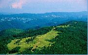 |
Pastures on Smith Mountain
|
|
The Roaring Plains and Flatrock Plains are the
highest plateaus of their size in the Eastern
United States. Together with Red Creek Plains,
“the Plains” are the geologic backbone of West
Virginia on Allegheny Front. The Allegheny
Front on the Plains is also the Eastern Continental
Divide in West Virginia.
Area forests and streams have significantly
recovered from devastating industrial
clear cut logging and many subsequent fires.
By the 1920s, clear cut logging and fires had
left these high plateaus a barren jumble of rocks
called “plains”. Since then, logging on these
USFS lands has taken place only on a few
small tracts. The natural grandeur of the Plains
and the steep slopes and valley floors below is
returning. Most of the Plains area owned by
the USFS (12,376 acres) has been managed
as if it were a protected Wilderness area since
the most recent Forest Service plan revision
of 1985. The Plains are surrounded on all sides
by very popular recreation destinations such
as Seneca Rocks, Spruce Knob, Dolly Sods,
Seneca Creek Back country, Canaan Valley,
Canaan Valley State Park, North Fork Valley,
Blackwater Canyon, Otter Creek Wilderness,
North Fork Mountain, and Smoke Hole Canyon.
|
|
|
|
|
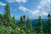 |
Spruce on Roaring Plains
|
|
CLIMATE
The weather on the Plains is one of its
special attributes. Weather changes are accentuated
on the Plains. Allegheny Front is a
mountain ridge over one hundred miles in
length that is a great weather modifier along
the east coast. The Plains are the highest point
along the entire front. Here there are winds of
a force factor of five, the greatest in West Virginia.
Wind in the spruce trees often sounds
as loud as a jet airplane taking off right above
you. Winter snows average approximately 180
inches (fifteen feet) of snow a year on the high
plateaus and lesser amounts on the lower
slopes and valley floors.
The Plains create a significant rain
shadow on the east side. The plateaus receive
roughly twice the annual precipitation as the
valley floors to the East. In the Potomac Valley,
cacti can be found along fences and grape
vineyards are within which require a drier climate.
Clouds hover above the Plains more
often than surrounding valleys. Days where the
valleys are in sunshine and the Plains are enshrouded
in cloud and thick fog are not uncommon
and can happen in any month of the
year. In winter, the mountaintop fog often deposits
thick rime ice in the higher forests. The
rime builds up and, when combined with the
high speed winds, breaks many branches off
the spruce to create flagged trees where all of
the upper branches only point east. There are
countless thousands of flagged spruce on the
Plains. The flagged spruce is a symbol of pride
and beauty for West Virginians of their Allegheny
Highlands.
Although nearby Dolly Sods is well
known for abundant snow and extreme winter
weather, elevations on the Plains are greater.
Weather extremes are somewhat greater on
the Plains. Snow can remain until June. Frozen
precipitation can happen during any month
of the year but generally happens from the
months of October through any time in May. Snow storms on the Plains are so common
that blizzards happen here when nearby towns
and cities get either winter rain or no precipitation
at all. Lake effect snows are common
on the Plains.
|
|
|
|
|
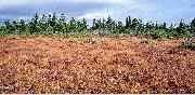 |
Sphagnum/cranberry bog
|
|
BIOLOGY / GEOLOGY: VEGETATION, WILDLIFE, STREAMS AND OTHER GEOLOGIC FEATURES
The highest point on Roaring Plains,
Mount Porte Crayon, is also the sixth highest
mountain in West Virginia and is worthy of
special attention due to its outstanding scenic,
natural, and ecological attributes. The only
mountain higher than Mount Porte Crayon in
the vicinity is Spruce Knob, 16 miles to the
south. The summit area of Mount Porte Crayon
is presently set aside as an 8.11 prescribed
management area, and is a Research Natural
Area, for a native mountaintop red spruce forest
that is home to endangered northern flying
squirrel and endangered cheat mountain salamander.
Mount Porte Crayon is remote headwaters
to three drainages and is the highest
point on the Eastern Continental Divide in West
Virginia, Maryland and Pennsylvania.
Of special note is that Roaring Plains towers 3,100 feet above the Potomac River at
the east base of the mountain. This is the greatest
vertical difference in West Virginia. Spruce
Knob, the highest point in the state, has somewhat
less vertical difference. Red Creek Plains
has similar vertical difference on its east slope
to Potomac River.
In these proposed Wilderness areas,
on and around the Plains, four points reach or
exceed an elevation of forty-seven hundred feet
and eight areas exceed forty-five hundred feet,
which is exceptional for the entire mid-Atlantic
region of the United States. Not only are many
cliff areas found on the Plains, but at least
seven known high elevation wetlands (sphagnum/
cranberry bogs), the highest in the state,
are there. These are home to rare northern
plants and animals such as the snowshoe hare,
bog lemming, bobcats, and fisher. These bogs
serve to regulate stream flow at the headwaters
for both sides of the eastern continental
divide.
Even after many decades of ecological
recovery from the timbering and burning
on the Plains, the surface is unusually rocky
and several dozen areas remain barren and
rocky. What soils remain are often thin (almost
always less than one foot) and are mainly peat,
the result of very slow buildup of primarily
spruce needles from the native conifer (red
spruce) forest. Before the timbering, this peat
layer was reported to be as deep as eight feet.
Locals report that the Plains’ plateaus had no
rocks exposed before the timbering and fires,
which is difficult to fathom today because as
you walk across Roaring/Flatrock/Red Creek
Plains, you get the feeling that the plateaus
are a never ending and contiguous jumble of
millions of large rocks one to two feet across
or larger. No matter how remote a location you
bushwhack to on the plateaus, you’ll find rocks
protruding from thin to non-existent soils.
Locals report that there was an economic
crash after the original forest was removed
in the 1920s and this was a primary
reason the USFS was able to purchase so
much land in the area. The rocky, unproductive
and snowy high country was sold while
more productive lower lands still remain mostly
in private ownership. Hard economic times
were also a cause for locals to repeatedly burn
the plateaus in the 1920’s and 30’s to promote
blueberries for food. The berries can still be
found in abundance to this day.
In addition to the native spruce forest
on top of the Plains, there are extensive and
virtually impenetrable laurel and rhododendron
thickets. They help to maintain a sense of
mystery for the area and also keep people on
the designated trails. The state DNR has rescued
at least one disoriented hunter in the laurels.
Incidents of people taking hours to go a
relatively short distance are reported regularly.
In late June the laurels bloom and there is a spectacular show of countless acres of
pink and white blossoms. The rhododendrons
typically bloom in July and add to the grandeur
of spring on the Plains. Spring may technically
end on June 21st, but because of the
high elevation on the Plains, spring arrives late.
Haystack Knob and Green Knob are
within the proposed area but are south of the
Plains. These are exceptional features. Haystack
Knob is unusual and special. It has historic
value as well as affording one of the best
mountaintop views in the state.
The USFS lands in Long Run valley
host an apparently healthy hardwood forest of
exceptional scenic and ecological value. These
slopes are perhaps the most remote USFS
lands in the proposed area. They are of great
value for persons seeking solitude and for wildlife.
They are also an important forest ecosystem
that must be considered as a single forest
system that spans from top to the bottom
of the mountain. Fauna that live in the spruce
forests on top also rely on lower elevation forests
for habitat and vice-versa.
|
|
|
|
|
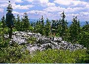 |
Looking east from Red Creek plains
|
|
RECREATIONAL OPPORTUNITIES
The Plains offer outstanding wild and
remote country experiences for many people.
They are within a day’s drive of a large percentage
of the U.S. population. The Plains are
less visited than the adjacent Dolly Sods Wilderness
area to the north primarily due to less
road access and fewer miles of designated
trails. The area offers many opportunities for
solitude of unusually good quality.
Backpacking: Backpacking is a popular
and perhaps the best way people enjoy the
Plains. Area trails have been well designed to
provide several circuit route opportunities
within the area as well as connecting to Dolly
Sods and even further north to Canaan Valley.
Some trail expansions need to be considered
such as a designated route to Haystack Knob,
Green Knob and the north cliff rim of Long Run
Canyon.
Running: In 2003 a forty mile
mountaintop marathon held by the West Virginia
Mountain Trail Runners traversed the
Plains to eventually end in Canaan Valley.
Future events seem likely.
Fishing: Streams within the proposed
areas are reported to host an abundance of
native trout populations. Fishing is one of the
most popular outdoor recreational sports in
West Virginia.
Hunting: Dear, turkey, bear, grouse and
other animals are abundant and already provide
outstanding hunting opportunities.
Exploration: Roaring Plains is unique
and ripe for exploration and there are many
rewards for it. A retired couple has dedicated
ten years to hiking and exploring the area
with high tech tools including a GPS. They
are still finding areas they’ve never visited. They
are still being rewarded in discovering great views as well as outstanding back country exploration
on and below the Plateaus. On all
sides of the Plains, there are many rocky outcrops
and other areas affording spectacular and
unparalleled views of the surrounding mountainous
countryside.
To date, at least forty two viewpoints
have been located; only three of them are on
designated trails. Each of these viewpoints
offers a different view from the other. Unlike
many mountains in the region, these are not
viewpoints along a single ridge where the view
only changes slightly from one to the next.
Rather, they are around the very curvy perimeter
of these dissected plateaus. A popular
exploration destination is Mt. Porte Crayon. Mt.
Porte Crayon is so remote and dense in vegetation
that most attempts at reaching the top
fail. The very scenic summit of Haystack Knob
also has no USFS designated trail leading to
it and is much farther from one than Mt. Porte
Crayon. Green Knob is even more remote, and
would take a serious effort to reach via bushwhack,
only across USFS lands from the closest
public access point on FR19 or Bonner Mountain Road.
Cross country skiing: The Plains receive
plenty of snow. An average of about 180
inches (fifteen feet) of snow every year falls on
the Plains. Trails and other routes on the Plains
offer outstanding remote skiing opportunities.
Nearby Whitegrass resort has hosted outings
to Roaring Plains and people venture in small groups every year to ski the Plains.
Snowshoeing: The Plains receive
plenty of snow. With an average of about 180
inches (fifteen feet) of snow per year, the Plains
offer outstanding opportunities for snowshoeing
and low impact winter recreation.
VISIT THE PLAINS
We urge you to consider visiting the
Plains. A backpack outing is probably the best
way to experience the area. The Monongahela
National Forest Hiking Guide by Bruce
Sundquist and Allen DeHart is recommended.
The West Virginia Highlands Conservancy
hosts outings to the Plains. Check the web
site Outings page (link provided below).
Designated trails exist but skip the
most scenic areas. If you are looking for a more
remote off trail experience consider the long
rock cliffs on the south edge of the Roaring
Plains on the north rim of Long Run Canyon.
Haystack Knob offers an outstanding view, too.
Search the Internet for “roaring plains map”
and see what you find. Be responsible for your
self and safety. Don’t under estimate how rugged
and dangerous this wild country can be,
especially off designated trails! Getting lost off
trail in the laurels and thick spruce forest presents
a real danger. This is not a place for the uninitiated. While on the flattish plateaus you
may not be able to see any distant landmarks.
GETTING THERE
Public access to Roaring Plains is from
Forest Road 19 to South Prong Trail. Bonner
Mountain Road offers public access to Flatrock
Run Trail.
From Canaan Valley, West Virginia:
Take 32 south. Stay on 32 past the state park
intersection then begin your descent out of the
valley. Take a hard left onto Laneville Road.
Laneville Road is very curvy and precarious in
spots and ends at Laneville and Forest Road
19. Before Laneville turn right onto Bonner
Mountain Road to reach the Flatrock Run Trail
head on the left (not far after the bridge over
Red Creek at a small gas pumping station). At
Laneville, Forest Road 19 starts up the mountain.
There are two trail heads on FR19 for
South Prong Trail on the right hand side. The
first trail head is closer to the bottom of the
mountain where the parking is off the road.
The second trail head is near the top of the
mountain just beyond the FS70 (FS70 is
gated) intersection. There will be a signed trail
head with roughly eight parking spaces.
From the east: From Petersburg, West
Virginia take 55 West. Pass Smoke Hole Caverns
on your right, and then pass a small gas
station on your left. Soon after you’ll reach Jordan
Run Road, a right-only turn. Turn right
onto Jordan Run Road. Go 1 mile up the mountain
and then turn left onto FR19. Go about six
more miles to the top of the mountain. You are
almost there. At the top stay left and then pass
the picnic area on your left. There will be a
signed trail head with roughly eight parking
spaces on the left hand side for the first trail
head for South Prong Trail. Another trail head
for South Prong Trail is further down the mountain
on the left hand side before Laneville.
AUTHOR: Jonathan Jessup.
|
| |
|
|
|
Author:
N Chappaz (OEP auth. reprod.)
Creation/last update: 18 January 2005 Recommended websites or webpages : More about the Roaring Plains - More information and photos about the Plains by Jonathan Jessup, in the West Virginia Highlands Conservancy website.www.wvhighlands.org - West Virginia Highlands Conservancy websitePhotos of the WV Highlands - Recent photographs of the West Virginia Highlands by Peter Jessup.How you can help - Click here to find out how you can help the Plains and Wilderness in West Virginia. |
|
|
|
|
|
|
|
| |
|
|
|
|
| |
|
|
| |
|